

Innovation Case Study: M-SNAP: Smarter Field Data for Stronger Environmental Outcomes
Mitchell Shire Council
Smarter mapping puts Council ahead on environmental protection and efficiency
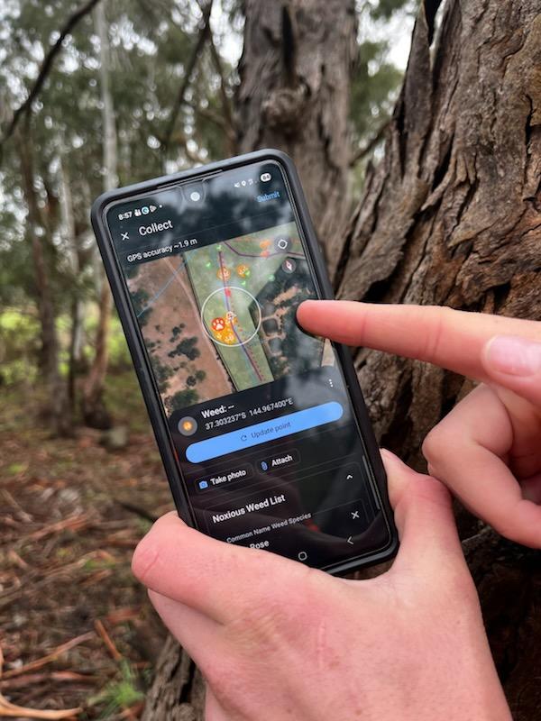
Mitchell Shire Council is proud to present “M-SNAP” (Mitchell Spatial Nature Asset Platform) a suite of user-friendly environmental mapping apps to improve how field data is captured, shared and used.
Co-designed with Environment and GIS team and environmental works contractors. The apps provide structured and accurate spatial data. The outcome is improved environmental management, efficiency, risk management and evidence-based decision-making.
2026 MAVlab Innovation Awards Finalist:
The Smooth Operator Award for Service and Systems Optimisation and Transformation, supported by Atturra

Project goals:
- Develop a practical, user-friendly environmental asset and management mapping system for Council staff and contractors.
- Improve the accuracy, consistency and accessibility of field data for weed control, nest box monitoring, research plots, roadside reserves and bushland reserves.
- Provide clearer maps and reliable offline functionality so contractors can work effectively in varied field conditions.
- Reduce internal GIS workload and post-processing by standardising seasonal contractor data across systems and formats.
- Enable live visibility of environmental works to support safer operations, better coordination, customer enquiries and risk management.
- Reduce manual, duplicated and inconsistent data collection so officer and contractor time can be focused on higher-value environmental work.
- Protect biodiversity through better information about sensitive sites.
- Create a scalable platform for future environmental monitoring, citizen science and other Council field-based activities.
Project team:
Day-to-day project delivery involved 6 Council officers. The Council project team included 2 GIS officers, 3 Environment team members and one IT officer, supported by 5 local weed control/environmental restoration/arboriculture contractors and their staff who helped test and refine the system in practical field conditions.
Team:
- Shirisa Timilsina, Geospatial Services Coordinator
- Ranju Pote, GIS Officer
- Kim Wilson, Environment Officer
- Elyse Kelly, Environment Coordinator
- Sonia Sharkey, Land Management officer
- Andrew Simeon, IT Systems Support Officer
- 5 local environmental works contractors and their staff.
Project duration:
Over two to three years, M-SNAP grew from a simple operational need into a practical suite of tools, driven by Environment officers and shaped by in house GIS expertise.
In 2023, the Environment team needed a better way to capture weed control data and coordinate reserve inspections. GIS officers translated that need into clear maps, reliable spatial data, mobile-friendly workflows and stronger offline functionality.
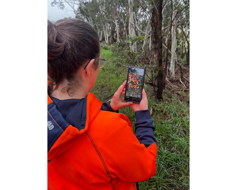
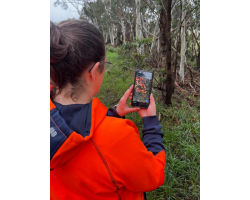
Working with environmental works contractors in the field (literally!) the apps were tested, refined and strengthened, helping turn M-SNAP into a user-friendly system that supports environmental work across the municipality.
Challenge and context:
The project addressed a long-standing challenge in how Council captured, managed and used environmental field data. Information about weed control, reserves, nest boxes, and other environmental assets and works was previously collected inconsistently, often through separate processes that were not seamlessly integrated with Council systems and usually paper based and entered manually into databases.
This created inefficiencies for both Environment and GIS officers, reduced confidence in data accuracy and limited visibility of live works occurring across the municipality.
The challenge was significant because environmental works are complex, place-based and often time sensitive. Mitchell Shire is a large Municipality with over 230Ha of Council managed environmental reserves and almost 1,000km of rural roadside treated for noxious weeds annually. Contractors need clear, practical information in the field, while Council officers need reliable data to support decision-making, risk management, customer enquiries and reporting. Without standardised methods, data could be interpreted differently by different users, making it difficult to compare results, understand emerging weed patterns or monitor how climate change is influencing the distribution of plant species.
The project also needed to work for a diverse group of users, including Council staff and contractors working in varied field conditions and with varying degrees of experience with mapping technology. Previous mapping approaches were not always effective on mobile devices, were difficult to use in the field and did not always support offline work. This made it harder to achieve consistent, accurate and efficient environmental monitoring at the scale required.
These constraints made the issue worthy of an innovative response. The project set out to improve data quality, build confidence in environmental monitoring, reduce unnecessary officer time, strengthen health, safety and environmental risk management, and create a practical system that supported contractors to spend more time delivering environmental improvement works and less time navigating administrative processes.
Solution and innovation:
The solution was to design and refine M-SNAP as a practical, user-centred environmental asset mapping and management apps for Council staff and contractors.
What sets M-SNAP apart from standard GIS tools is that it was not developed as a technical mapping product first and then handed to field users. It was built from an identified operational need, shaped by the people doing the work on the ground, and refined around the realities of on ground environmental works across a large rural municipality.
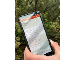
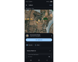
The apps were co-designed with the people who would use it most. Environment officers and contractors who were literally on the ground, spotting weeds, navigating reserves and recording works. Council’s GIS officers then translated that into clear spatial layers, mobile-friendly forms, simple workflows, reliable offline functionality, and outputs that could be used immediately by officers and contractors.
The innovation both technical and operational, M-SNAP turned an existing unreliable paper-based method into live data collection using a centralised and standard digital spatial system.
Continuous improvement principles were applied. A pilot project was configured; however, the original design was difficult to use in the field, did not store data offline, did not display well across mobile screen sizes and often required contractors to rely on tablets or laptops. This limited efficiency, accessibility, and consistent data collection.
Another key strength is that the system was developed in house at very low cost. Rather than relying heavily on consultants, Council used internal GIS, Environment, and IT capability, supported by operational contractor testing and feedback. This kept costs low, built internal and local contractor capability and ensured the platform remained practical, adaptable and owned by the people responsible for using and improving it.
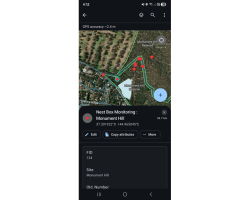
M-SNAP has since expanded beyond weed control to capture environmental assets and broader environmental works.
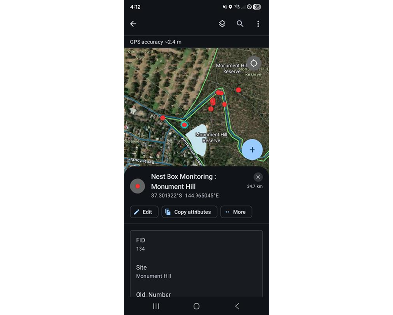
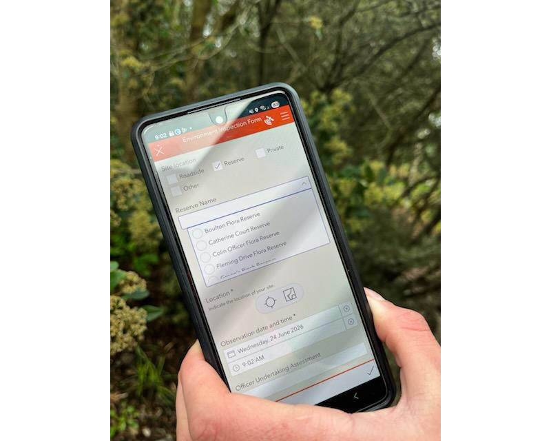
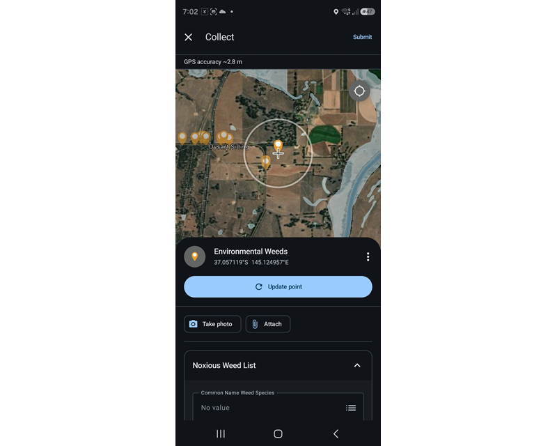
The approach has also changed the way teams think about digital tools. Instead of treating mapping as a stand-alone technical task, Council has demonstrated how co-designed systems can improve service delivery, risk management, biodiversity protection and contractor engagement at the same time.
Project impacts and short-term outcomes:
The project delivered immediate and practical outcomes for Council staff, contractors and the community. Environmental works are now mapped consistently by 100% of the environmental works contractors on Council’s panel, with clearer field guidance and improved visibility of where contractors are working and what activities have been completed. This has reduced reliance on follow-up communication, made customer enquiries easier to respond to, and supported more timely decision-making by giving officers access to current field information.
Contractors are spending less time on manual or duplicated mapping processes and more time undertaking their important field work. The application has also improved confidence in the accuracy and consistency of data collected in the field.
The project has strengthened health, safety and environmental risk management by providing live data on environmental works. It has also supported better biodiversity protection, as demonstrated through fire prevention works where accurate maps enabled contractors to complete required works while avoiding impacts to rare and threatened species.
A strong example of the solution’s value was its use in fire prevention works along a highly significant roadside containing rare and threatened species, including the spotted hyacinth orchid. Staff used the application to prepare accurate maps for contractors, helping deliver the required fire prevention outcome while protecting significant biodiversity values.
In fact local contractors have reported that the app is quick and easy to use, with some preferring it to other mapping programs.
Capability and long-term impacts:
The project has strengthened Council’s capability by establishing a more reliable, adaptable and user-centred approach to environmental data collection. As well as providing efficiencies, it has improved coordination between Environment officers, GIS staff and contractors, and created a stronger shared understanding of how environmental works should be recorded, monitored and used to inform future planning.
Documented user guides, field training and ongoing contractor and staff feedback have built technical literacy and confidence among users. This has economic and operational benefits, including stronger relationships with local suppliers, improved business networks and more efficient use of officer time.
The project has also created a platform for continuous improvement, with new version control, better data backup processes and ongoing refinements based on user experience.
Beyond the original project timeframe, the system is helping Council become more resilient and responsive. Better environmental monitoring and recording means officers can more readily identify and share new and emerging weeds, rare or threatened species, while overtime comparing data to better understand changes in plant distribution and respond to climate-related shifts in the landscape. The project has therefore contributed to a stronger evidence base for environmental management and future decision-making.
The approach has also changed the way teams think about digital tools. Instead of treating mapping as a stand-alone technical task, Council has demonstrated how co-designed systems can improve service delivery, risk management, biodiversity protection and contractor engagement at the same time.
Scalability and transferability:
The project is highly transferable because it is based on a practical model that other organisations, councils and teams can adapt: identify field data gaps, co-design with users, pilot in real conditions, refine based on feedback, and support adoption through training and simple guidance.
This approach can be applied to a wide range of functions where field-based data, contractor coordination and live visibility are important. Mitchell Shire Council uses one of the most commonly used spatial systems across government and NGO’s, making it easily transferable with the ability to scale up or down depending on the project needs.
Transferability is already being demonstrated with the Goulburn Broken Catchment Management Authority and Euroa Arboretum adopting the Mitchell Shire Council’s online spatial data collection form and layer for nest box monitoring. Following the recent Longwood fires, these organisations needed a rapid-response solution to map and monitor newly installed nest boxes providing vital habitat destroyed in the fires. Council was able to easily share the application, helping create greater consistency and a coordinated approach at a landscape scale.
Internally, the Environment and Sustainability team is exploring how the platform could support illegal waste dumping mapping, while planning, landscape and assets teams have identified further potential for field data collection applications.
The system also has potential for community-facing citizen science initiatives, such as nest box monitoring. By creating a scalable platform that can be reused, adapted and shared, the project contributes to improved local environmental stewardship, stronger biodiversity outcomes and more consistent knowledge sharing across agencies and communities.