

Innovation Case Study: Modern Asset Management meets Biodiversity Protection and Public Safety
Stonnington City Council
Future-ready infrastructure connecting people, nature and technology
Stonnington Council embarked a multi-year project of upgrading Kooyongkoot shared path along the Gardiner Creek. This first stage served as designing a blueprint for building an inter-generational resilient infrastructure that will provide a shared path with modern public lighting management, biodiversity protection, reduction of adverse emissions whilst maintaining public safety. Building the inaugural IoT observation Station further futureproofed the project.
2026 MAVlab Innovation Awards Finalist:
The Resilient Infrastructure Award for Emergency-ready Community Systems, supported by Matter

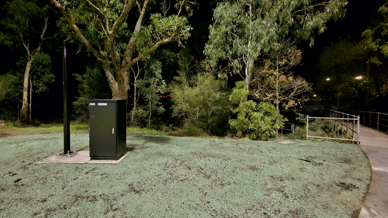
The Gardiners Creek Iot (Internet of Things) Observation Station
Project goals:
- Create a resilient asset to be used by communities 24/7
- Building a shared path for pedestrians and cyclists
- Improving the safety of the pedestrians and cyclists
- Delivering modern public lighting that will include:
- protection to the local biodiversity,
- reduction of adverse emissions,
- remote fault management of the public lighting assets,
- maintaining a high level of public safety.
- Build an IoT (Internet of Things) observation station - a powered council asset that will be used for monitoring flooding events, water quality, litter, traffic volumes and risks, and for any future technologies and collaborative inter-agencies use cases.
Project team:
Between 10 and 20 people: Stonnington's Landscape team are the principal project delivery team. In addition, Stonnington Smart City Lead, Lighting Consultant and Electrical contractors were key contributors to the project.
Team or contributors:
- Georgina Hagger - Coordinator Landscape Projects * City Projects * Stonnington Council
- Alex Hogan - Senior Landscape Architect * City Projects * Stonnington Council
- David James McCarthy - Landscape Project Manager * City Projects * Stonnington Council
- Goran Babusku - Smart Cities Lead * Digital Transformation * Stonnington Council
- Robert Hamilton - Associate Consulting Engineers - Webb Australia Group (VIC) PTY LTD
- Patrick Curtin - Electrical Contractor - Eco Electrical Services
- Neil Sutton - Gardiners Creek (KooyongKoot) Collaboration Lead - Melbourne Water
- John Preece - Civil designers- Stantec
- Furniture was designed by Taylor Cullity Lethlean (TCL)
- Built by Terraform.
Project duration:
The construction duration was 4 months.
12 months for the non-construct timeline: cultural heritage studies, consultations, PM, permitting and design.
Challenge and context:
The Kooyongcoot shared path upgrade along Gardiner Creek began as a straightforward brief: resurface and improve an existing shared path for the Stonnington community. What emerged was something far more ambitious.
As design progressed, it became clear that the required public lighting could not be treated as a standard streetscape intervention. The creek corridor runs through less accessible parts of the municipality, meaning lighting faults would be difficult to detect and slow to resolve under conventional maintenance models. Simultaneously, the local environment imposed real constraints — light spill and poorly designed fixtures risked damaging the nocturnal habitat that makes this green corridor environmentally valuable. Resolving maintenance efficiency, public safety, biodiversity protection and energy reduction within a single lighting solution required a step up to smart technology, adding design complexity to the project.
The challenge deepened through stakeholder engagement. Consultation with water authorities, environment protection agencies and local community groups uncovered a further unmet need: reliable, ongoing water quality monitoring of the creek. No mechanism existed to capture this data consistently, yet multiple stakeholders depended on it. This reframed the project's scope.
The team identified that a single powered, connected asset could address environmental monitoring, flood and litter alerts, pedestrian and cyclist traffic data collection, and future technologies integration in one solution — giving rise to the IoT observation station concept.
Delivering this without an established template or Council precedent meant building alignment across engineering, environmental, digital and external stakeholders simultaneously — a significant coordination challenge layered on top of an already complex technical one.
Critically, this first 0.7km section of the Kooyongkoot path is deliberately designed as a replicable blueprint for the remaining 8km of the corridor. That makes the stakes considerably higher — and the need to get it right from the outset essential.
Solution and innovation:
Rather than treating each emerging requirement as a separate problem, the team made a pivotal early decision: design a single integrated asset capable of addressing multiple needs simultaneously — and evolving as future needs arise. This systems-thinking approach, unusual for a path upgrade of this scale, became the foundation of everything that followed.
Smart Lighting Reframed
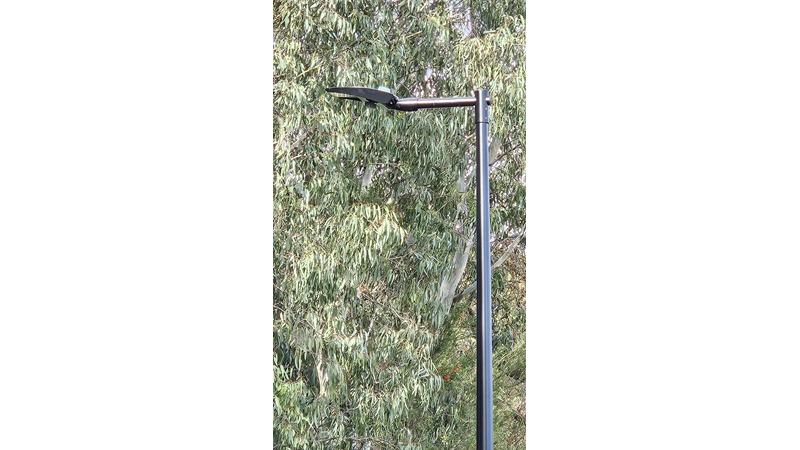
Instead of procuring standard public lighting, the project adopted a smart lighting system with remote fault monitoring, real-time alerts, and adaptive controls. Every light fitting along the corridor is designed to accept plug-in sensors, converting the luminaires into a multipurpose smart node capable of air quality monitoring, traffic sensing, noise monitoring or whatever future need emerges. Remote faults alerting, dynamic adjustment of light intensity and colour temperature allows the system to dim and shift colour spectrum after hours — actively protecting the nocturnal wildlife. Biodiversity and lighting were considered within the same design brief.
The IoT Observation Station
The project's most original element emerged directly from stakeholder engagement. Consultation revealed no powered assets existed along the corridor, yet multiple agencies had unmet data needs. Rather than point solutions for each, the team designed a modular IoT observation station — a connected infrastructure node built to host current and future sensing technologies. Traffic monitoring will be live within weeks, water quality sensors to follow, unlocking data-sharing opportunities with other authorities. Future technologies can be added without retrofitting. The station turns a path upgrade into a living environmental monitoring platform.
Inclusion and Accessibility
Improved lighting directly addresses personal safety after dark — a known barrier to path use for women, older residents and mobility aid users. Reliable, motion sensing lighting makes the corridor more welcoming 24/7.
Designed to Scale
Every decision was made with the remaining 8km of corridor in mind. This is not a pilot. It is a blueprint.
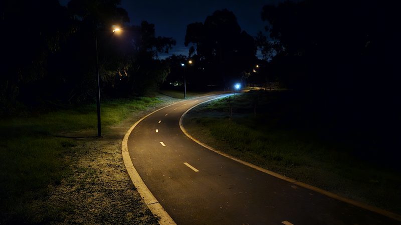
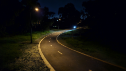
bioDiverse Orange light with cyclist white light for comparison
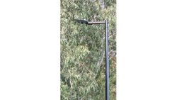
Smart light with dual sensing capability
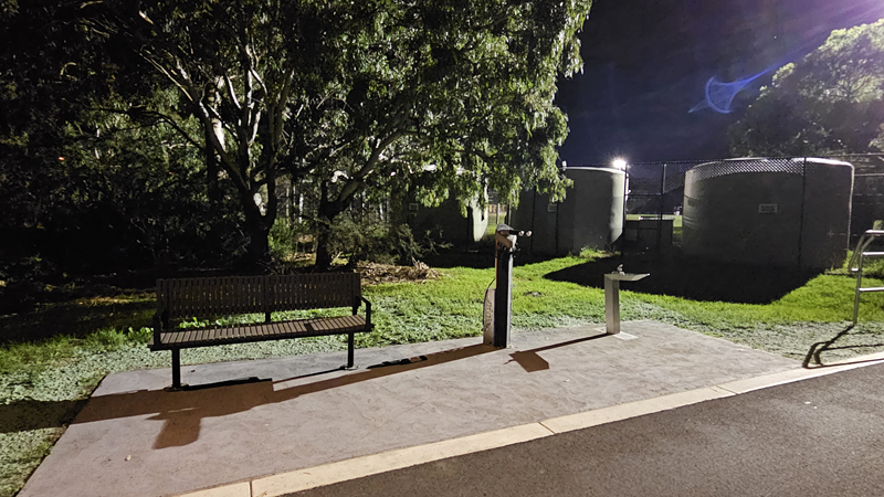
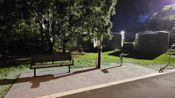
Bike repair station and resting furniture
Every decision was made with the remaining 8km of corridor in mind. This is not a pilot. It is a blueprint.
Project impacts and short-term outcomes:
The Kooyongkoot shared path upgrade went live on 15 May 2026, meaning the project is in its earliest weeks of operation. Long-term performance data is still being established, however, several direct outcomes are already evident.
Smart Lighting Performance
29 smart lights were commissioned across this section of the Gardiner Creek corridor. Within the initial commissioning period, 3 lights registered faults — all identified automatically by the remote monitoring system and resolved remotely, with minimal site revisits. Under conventional maintenance practice, each fault would have required separate crew deployment to a location with challenging vehicular access. The smart system collapsed what would have been multiple reactive site visits into a single remote intervention. This is a direct, measurable demonstration of the maintenance efficiency the system was designed to deliver.
Infrastructure Enablement
The IoT observation station is operational and will soon start Pedestrian and cyclist traffic monitoring, beginning to establish the baseline data that did not previously exist for this corridor. Water quality monitoring equipment will be integrated next, with data-sharing opportunities with agencies like water and pollution authorities and LGAs.
Equity and Accessibility
The upgraded path and improved lighting directly enhance safety and accessibility for all corridor users — including women, older residents, and mobility aid users — during evening hours when the previous lighting standard was inadequate.
Foundation for Measurement
Pre-project pedestrian count data exists and will serve as a baseline for future comparative analysis. Energy consumption, water quality and traffic pattern data will be reportable within 12 months, providing a robust evidence base for the replication of this model across the remaining 8km of corridor.
Capability and long-term impacts:
This project has done more than deliver infrastructure — it has established a foundation for how Stonnington will design, deliver and manage shared path upgrades from this point forward.
New Ways of Working
Internally, transport, sustainability, environment and smart city teams worked from a shared brief — breaking the sequential, siloed approach that had been the default. But the more significant shift was external. For the first time, Stonnington requested that external partners — lighting designers, electrical contractors and construction managers — go beyond conventional delivery and actively contribute best-practice knowledge to shape how this solution could be replicated more efficiently across future sections. The results were tangible: electrical contractors identified cabling efficiencies that reduced cost without compromising outcomes; construction input led to relocation of the IoT station to a position that was both physically and financially superior. That culture of collaborative inquiry is now the expected model for all subsequent corridor sections.
Documented Learnings and Replication
The first section has produced a replicable playbook. Lighting schedules, motion sensor configurations, IoT station specifications and monitoring integrations are documented and transferable for future sections. IoT observation stations will no longer be afterthoughts. They will be standard inclusions, designed in from the outset of every future implementation. The learning curve has been absorbed once and won't need to be repeated.
AI-Ready Data Infrastructure
The smart infrastructure generates clean, structured, real-time data — AI-ready by design. Council is not just collecting data; it is building an intelligence asset queryable in natural language, enabling more sophisticated decision-making as analytical tools evolve. An Infrastructure ready for questions we haven't thought to ask yet.
A Foundation for Victoria and Beyond
The core achievement is instilling future-proofing thinking permanently into how Stonnington plans and delivers infrastructure — intergenerational in ambition, replicable by design.
Scalability and transferability:
Scalability was not an afterthought — it was a design requirement from day one.
Built to Replicate
This 0.7km Kooyongkoot section is explicitly the first of many. The remaining 8km of Gardiner Creek shared path will be delivered using this as the foundation. Every specification, configuration and procurement decision was made with replication in mind. Lighting schedules, light fittings, poles, motion sensor configurations, IoT station specifications and monitoring integrations are documented and transferable — plug-and-play for every section that follows.
A Pioneer Model for the Sector
As far as we are aware, no other council in Victoria or Australia has delivered a purpose-built IoT observation station and smart-lighting within a shared path infrastructure upgrade. Stonnington is a pioneer. And yet the converging challenges this project resolved — inaccessible maintenance, biodiversity sensitivity, unmet environmental monitoring, absence of powered assets — exist on shared paths everywhere. The practical knowledge developed here: how to procure smart lighting, configure motion-sensing schedules, and position IoT stations for construction and cost efficiency, is directly transferable to any council facing the same challenges. Stonnington is actively positioning this as a foundation for sector-wide adoption.
UN Sustainable Development Goals
This project delivers against four SDGs concretely:
SDG 11 (Sustainable Cities): smart lighting and IoT infrastructure make the corridor safer, more accessible and more efficiently maintained.
SDG 13 (Climate Action): motion-activated lighting reduces energy consumption while the IoT station establishes environmental baseline data for creek monitoring.
SDG 15 (Life on Land): adaptive dimming and colour temperature shifts actively protect nocturnal wildlife along a biodiverse urban corridor.
SDG 17 (Partnerships for Goals): data-sharing opportunities with Melbourne Water, EPA and neighbouring councils demonstrate cross-sector collaboration delivering shared environmental outcomes.
The Ambition
Every shared path in Australia should be built this way. This project proves it is possible.