

Innovation Case Study: Mornington Peninsula Community Disaster Resilience Plan
Mornington Peninsula Shire Council
A whole-of-community approach to strengthening local preparedness, connection and recovery
Through community-led networks, a new Emergency Dashboard, targeted water safety partnerships and the Resilience, Relief and Recovery Network, this project brings Council, emergency services, local groups and residents together to reduce disaster risk and support shared responsibility.
2026 MAVlab Innovation Awards Finalist:
The Stronger Together Award for Council Collaboration, supported by Davidson

Project goals:
- Strengthen community preparedness before, during and after emergencies.
- Support residents, visitors, businesses and community groups to understand local risks and take practical action.
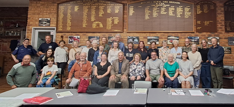
- Build and sustain local resilience networks, including the Hill & Ridge Emergency Network and Shoreham Resilience Network.
- Improve coordination between Council, emergency services, community organisations and local leaders through the Resilience, Relief and Recovery Network.
- Provide clearer, more accessible and localised emergency information through the Emergency Dashboard.
- Support people to be self-sufficient for at least 72 hours if roads, services or support are disrupted.
- Embed inclusion by focusing on priority populations, including older people, people with disability, multicultural communities, visitors, short-stay accommodation users and people experiencing disadvantage.
- Reduce drowning risk through cross-council water safety partnerships.
- Translate community engagement into visible, practical projects.
- Create a scalable model and approach that other townships and councils can adapt.
Project team:
There are 5 members of the Community Resilience and Emergency Management Team at the Shire.
Virginia Richardson (Community Resilience Officer), and Andrew Brick (Team Leader) were the main contributors, supported by Abbey Evans, Brett Fletcher and Fleur Robinson.
Project duration:
- Background research for the plan - July-November 2024
- Framework and engagement plan October 2024 - March 2025
- Community Engagement - April and May 2025
- Draft plan developed - June 2025
- Council briefing and meeting - August - September 2025
- Draft plan on public exhibition - October 2025
- Adopted by Council - December 2025
- Implementation 2026 - 2030
- Action Plan reported on annually to council.
Challenge and context:
Mornington Peninsula Shire faces a complex disaster resilience challenge. The municipality includes coastal settlements, rural landscapes, townships, high-visitation areas, bushfire-prone communities, ageing populations, vulnerable road networks and places where access to services and information varies significantly. Key risks include bushfire, storms, flash flooding, heatwave, landslides, coastal hazards, and prolonged service disruption.
Recent emergencies highlighted that disasters can quickly disrupt power, water, roads, communications, business continuity and access to essential services. In some communities, residents may need to be self-reliant for at least 72 hours, especially where help cannot immediately reach where it is needed.
The challenge was not simply to produce another emergency management document. Council already has formal responsibilities through the Municipal Emergency Management Plan, but community feedback and local experience demonstrated a need for clearer public-facing coordination: what Council was doing, how communities could be involved, and where people could find trusted local information before, during and after emergencies.
The scale and diversity of the municipality made this difficult. Disaster resilience does not sit with one team, agency or community group. It relies on shared responsibility across Council departments, emergency services, local businesses, community organisations, volunteers, neighbourhood networks, residents and visitors.
More than 600 community members contributed through workshops, pop-ups, scorecards, surveys and network conversations, including 541 community scorecards and 86 online survey responses. This engagement identified that communities wanted clearer emergency information, localised planning, stronger neighbourhood networks, practical preparedness tools and opportunities to build confidence before an event occurs.
Some groups face additional barriers to preparedness and recovery, including older residents, people with disability, carers, multicultural communities, people living alone, people on low incomes, people experiencing homelessness, tourists and people who may not receive or understand standard emergency messages. This made an innovative, place-based and inclusive response essential.
Solution and innovation:
The Community Disaster Resilience Plan is a practical framework for connecting Council’s emergency management role with community-led preparedness and local action. Its innovation is in shifting the focus from an Council/agency-led model to a shared resilience model: Council as enabler, connector, advocate, communicator and partner.
The project combines several complementary initiatives rather than relying on a single campaign or document. The Hill & Ridge Emergency Network demonstrates the value of local leadership after severe storms left semi-rural communities without power, water, internet and access to essential services for up to two weeks. With support from CFA’s Community Based Bushfire Management program and Council, the network now supports 53 street leaders and approximately 1,000 residents to share preparedness information, strengthen neighbour-to-neighbour connection and build local resilience.
The Shoreham Resilience Network has replicated this model in an adjacent township, with 25 street leaders and more than 200 residents connected through WhatsApp and other local communication channels. It supports township-level preparedness and community-led planning that reflects local risk, geography and community strengths.
The Resilience, Relief and Recovery Network provides a formal collaboration mechanism between Council departments, NGOs, community groups, businesses and community representatives, keeping locals connected before, during and after emergencies.
The Emergency Dashboard adds a clear digital entry point for trusted information, providing access to more than 50 sources of preparedness information, translatable into 95 languages. It can also adapt during an event through response and recovery tabs, reducing confusion while directing people to authoritative sources such as VicEmergency and 000.
Inclusion is embedded through varied engagement methods, accessible information, translated and easy English resources, hard-copy options, priority population planning and targeted initiatives such as multicultural water safety programs. The solution is innovative because it combines formal governance, local data, digital information, community-led networks and practical action into one integrated resilience approach.
The project has strengthened council capability by turning disaster resilience into an ongoing way of working, rather than a stand-alone emergency management activity.
Project impacts and short-term outcomes:
The project delivers tangible outcomes within the life of the Community Disaster Resilience Plan and associated initiatives.
The Plan creates, for the first time, a clear public roadmap for community disaster resilience on the Mornington Peninsula. It sets out practical objectives, actions, networks and programs, making Council’s work in preparedness, response and recovery more visible, and easier for the community to understand.
A major outcome is the scale and quality of community engagement. More than 600 people contributed to the Plan, including 541 community scorecards and 86 online survey responses. This provided Council with a baseline understanding of local risk perception, preparedness needs, community strengths and priorities that can be measured over time.
The Plan has translated engagement into practical local action. The Hill & Ridge Emergency Network strengthened preparedness in Red Hill, Main Ridge and surrounding areas, with 53 street leaders and approximately 1,000 residents connected through local preparedness activity. It helped turn a severe storm experience into sustained community action, with residents, local groups, CFA, SES, Council and other partners working together around shared risk.
The Shoreham Resilience Network provides a second local network model, with 25 street leaders and more than 200 residents connected through local communication channels. Work is continuing with both communities to develop Local Emergency Action Plans that reflect local strengths, risks and access challenges.
The Emergency Dashboard improves access to trusted local information by providing a streamlined pathway to more than 50 sources of preparedness information, translatable into 95 languages.
The Resilience, Relief and Recovery Network has strengthened coordination between council, local organisations and community representatives. Regional water safety work has also delivered targeted prevention outcomes for multicultural communities and other priority populations at higher risk of drowning.
Together, these outcomes show engagement moving beyond consultation into practical, visible and community-centred action.
Capability and long-term impacts:
The project has strengthened council capability by turning disaster resilience into an ongoing way of working, rather than a stand-alone emergency management activity.
The Community Disaster Resilience Plan provides a clear strategic framework for Council’s community resilience work from 2025 to 2030. It supports annual reporting, internal action planning and alignment with the Council Plan, Municipal Public Health and Wellbeing Plan, Municipal Emergency Management Plan and community engagement work. This creates a stronger governance base for resilience and helps embed preparedness across council systems.
The Resilience, Relief and Recovery Network builds enduring coordination capability by bringing council departments, non-government organisations, community groups, businesses and community representatives together before emergencies occur. Its terms of reference support regular meetings, shared agendas, action registers, reporting to the Municipal Emergency Management Planning Committee and flexible activation during emergencies, so relationships, roles and communication channels are already in place when needed.
The local resilience networks strengthen council’s ability to work with communities as partners. Hill & Ridge and Shoreham demonstrate that local knowledge, trusted relationships and neighbourhood-level leadership are essential resilience assets. Council’s role has shifted from simply providing information to enabling local capability, supporting community leadership and connecting township networks with emergency services and other partners.
The Emergency Dashboard strengthens organisational communication capability by creating a single source of local emergency information that can be promoted consistently across council, community and partner channels. Its adaptable structure allows response and recovery information to be added during an event, improving council’s ability to communicate clearly under pressure.
The project also strengthens learning and adaptability. By documenting actions, networks, case studies, engagement findings and future opportunities, Council can identify what works, replicate successful approaches and improve over time. The broader system benefit is a practical model for equitable, community-centred resilience.
Scalability and transferability:
This project is highly scalable because it is not dependent on one location, hazard or delivery model. It provides a practical framework that can be adapted by other councils, townships and teams.
The local resilience network model can be replicated by starting with local risk, existing relationships and trusted community leaders. Hill & Ridge and Shoreham show that networks do not need to be built from scratch. They can grow from existing fire brigades, neighbourhood groups, newsletters, community associations, local businesses, schools, service clubs, informal networks and volunteer leaders. Other councils could adapt this approach for bushfire-prone, flood-prone, coastal, peri-urban, rural or isolated communities.
The Emergency Dashboard model is also transferable. Councils can apply the same principle of a single, trusted online entry point that brings together local emergency information, preparedness advice, warnings, outages, recovery information and links to authoritative sources. The ability to add response and recovery tabs during an event makes it useful for both preparedness and activation.
The Resilience, Relief and Recovery Network provides a replicable governance model for bringing council teams, agencies, community organisations, businesses and local representatives together before emergencies occur. Terms of reference, rotating meeting locations, hybrid participation, action registers and links to formal emergency management structures could all be shared with other councils.
The water safety plan demonstrates cross-council scalability by working with Bass Coast, Casey, Cardinia and Greater Dandenong Councils, Life Saving Victoria, Belgravia Leisure and community partners to address a shared regional risk.
The core elements for success are genuine engagement, a strengths-based approach, trusted local leaders, practical projects, clear links to authoritative emergency sources, and ongoing feedback and adaptation. The central lesson is transferable: resilience is built through relationships, trust, local knowledge and repeated opportunities for people to take practical action together.
Learn more:
- Community Based Bushfire Management - Hill and Ridge Emergency Network | Country Fire Authority (YouTube)
- Community Disaster Resilience Plan | Mornington Peninsula Shire Council
- Community Disaster Resilience Plan: A Plan for a Disaster Resilient Mornington Peninsula 2025-2030 (PDF - 1.83MB)
- Emergency Dashboard | Mornington Peninsula Shire Council
- Emergency Dashboard A4-Flyer (PDF - 1.29MB)
- The Hill & Ridge Emergency Network Flyer (PDF - 65.7KB)